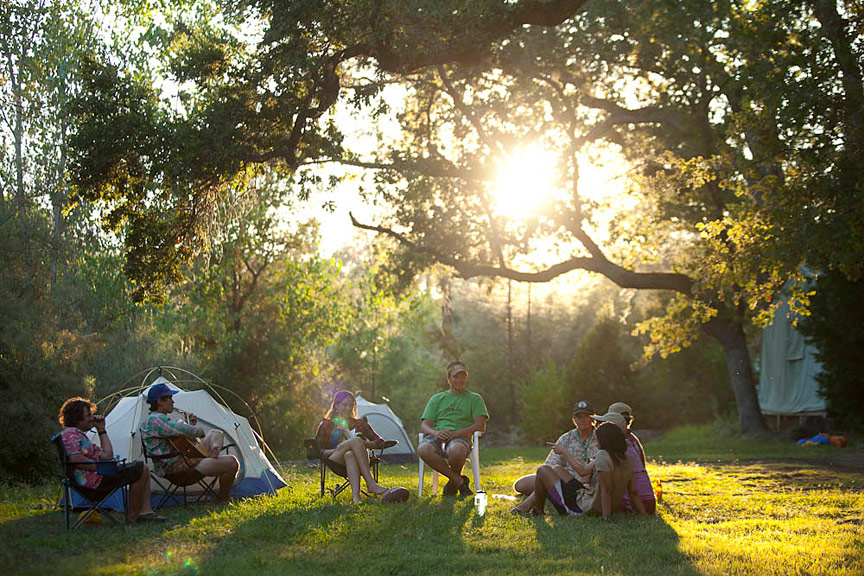
Things to Do Before or After an American River Trip
Parks in the Area
This beautiful park stretches along the banks of the North and Middle Forks of the American River. It is rich with gold rush history, as many people called the banks of the American “home” while in search of riches. There are ample activities in the Auburn State Recreation Area for the outdoor and history enthusiast, including hiking, biking, rafting, fishing, swimming, camping, horseback riding, and gold panning.
Keep in mind that if you are visiting to explore on foot or on the water, there are day use and camping fees. Please visit the website for detailed information on use fees.
501 El Dorado Street
Auburn, CA 95603
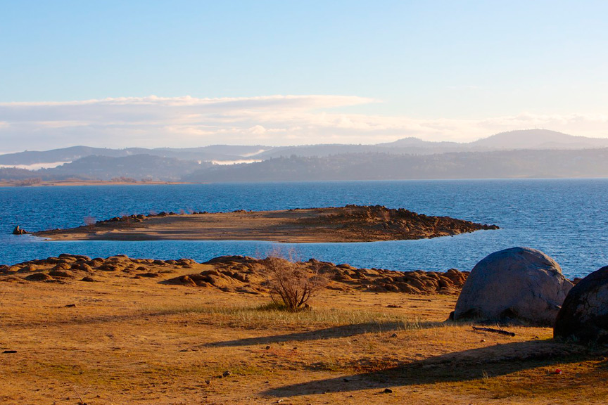
Folsom Lake State Recreation Area
Folsom Lake is nestled at the base of the Sierra foothills; this State Recreation Area offers a wide variety of activities for visitors. The park boasts 95 miles of trails for a range of activities including hiking, camping, running, biking, and horseback riding. On the water, there are opportunities for fishing, boating, and water skiing. A wealth of information can be found on the Folsom Lake SRA website, including hours of operation, rules and regulations, and information on boating on the lake.
Boat ramp and campground information can be found in the map at the end of the Folsom Lake SRA Brochure. Hiking and riding trails, including designated horse assembly locations, can be found in this map. Please check the Folsom Lake SRA website for day use and camping fees.
7755 Folsom-Auburn Road
Folsom, CA 95630
Trails: Hiking, Biking, and Horseback Riding
Foresthill Divide Loop Trail: Hiking, Biking
Trail: 8.2 miles
Type: Loop, single track
Difficulty: Easy to Moderate
Day Use Fees: $10 Parking
Interesting Fact: When Foresthill was a thriving site for gold mining, Lime Rock was a strategic outlook for the outlaws of the Gassaway Gang. The Gassaway Gang was famous for holding up stagecoaches on their way to Auburn from Foresthill.
Notes: this trail straddles the Foresthill Divide, offering views of both the North Fork and the Middle Fork American River canyons. It crosses through many ecosystems, including yellow pine forests and open grassland.
West Trailhead: on Foresthill Road, 3.5 miles east of Foresthill Bridge
Lat/Long: N38-56-561; W120-58-946
East Trailhead: on Foresthill Road, 7 miles east of Foresthill Bridge (just past Driver’s Flat Road) at a large parking area on the left
GPS Coordinates: 38.94272,-120.982632
Hidden Falls Trail: Hiking, Biking, Horseback Riding
Trail: 5.6 miles
Type: Loop
Day Use Fees: Free; parking is limited
Trail: This hike is good for all ages and skill levels. The hike includes access to waterfalls and scenic vistas. Can be crowded on holidays and summer weekends.
More information including park information and maps can be found on the Placer County website.
Address: 7587 Mears Place, Auburn CA 95603
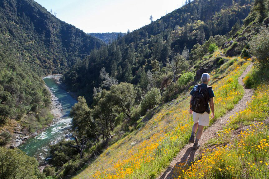
Lake Clementine Trail: Hiking, Biking, Horseback Riding
Trail: 1.9 miles
Type: Out & back, single track
Difficulty: Easy
Day Use Fees: $10 or CA Parks Poppy Pass
Notes: This easy trail includes regular panoramic views of the North Fork of the American River. Many side trails lead down into the river canyon.
Trailhead: At the confluence area, 1.75 miles south of the Auburn SRA headquarters. Park on the right, just past the Old Foresthill Bridge. The trailhead is on the left across from the parking area.
Address: 139 Old Foresthill Road, Cool, CA 95614
Olmstead Loop Trail: Hiking, Biking, Horseback Riding
Trail: 8.6 miles
Type: Loop, single track
Difficulty: Easy to Moderate
Day Use Fees: Unknown
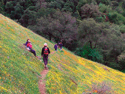
Notes: This loop crosses two creeks and includes many side trails which offer beautiful views of the North Fork American River canyon. You’ll also have a chance to look out over the abandoned Auburn dam construction site. The loop is particularly popular in the spring, when wildflowers are abundant.
Trailhead: behind the fire station in Cool, CA, just off Highway 49.
Address: Between 7207 and 7299 Saint Florian Court, Cool, CA 95614
Quarry Trail: Hiking, Biking, Horseback Riding
Shorter Trail: 3.6 miles
Medium Trail: 5.6 miles
Longer Trail: 10.4 miles
Type: Out & back
Difficulty: Easy
Day Use Fees: $10 or CA Parks Poppy Pass
Notes: this trail has many different options, allowing you to choose between a shorter hike straight to the quarry or a longer hike surrounding the area.
Trail: This path follows the historic railway which transported limestone from the quarry to Auburn for cement production. It is also part of the Western States Trail, which is used for the Tevis Cup each year. The trail is wide, smooth, and mostly river. Great vistas of the Middle Fork of the American River.
Address: California 193, Cool, CA 95614
GPS Coordinates: 38.915036, -121.023358
Robie Point Firebreak Trail: Hiking, Horseback Riding
Trail: 3.6 miles
Type: Out & back
Difficulty: Easy to moderate
Day Use Fees: Unknown
Trail: This is a well-maintained trail. Great views of the North Fork of the American River; abundant wildflowers in the spring.
Address: Between 162 and 198 Shady Glen, Auburn, CA 95603
Stagecoach Trail: Hiking, Biking
Trail: 2 miles
Type: Out & back, single track
Difficulty: Moderate up, easy down
Day Use Fees: Unknown
Interesting Fact: this historic trail was built in 1852, originally known as Yankee Jim’s Turnpike. The road led to a toll bridge across the North Fork of the American River.
Notes: This trail is short and moderately easy. There are great wildflowers in the spring and stunning vistas year round.
Trailhead: At the confluence area, 1.75 miles south of the Auburn SRA headquarters. Just past the intersection of Highway 49 and Old Foresthill Road, there is a parking area on the left.
Address: 137 Old Foresthill Road, Cool, CA 95614
Western States Trail: Hiking, Horseback Riding
Trail: Up to 100 miles
Type: Single track
Difficulty: Easy to Difficult, depending on the section you choose
Day Use Fees: $5 Suggested Donation
Trail: This trail was originally created and maintained for the Tevis Cup, founded in 1955. The Tevis Cup is a 100.2 mile endurance race for horses which run from Squaw Valley, CA to Auburn, CA. In 1974, Gordon Ainsleigh first ran the trail on foot, finishing in 23 hours and 42 minutes. This pioneer run serves as the founding of the Western States Endurance Run, which is the oldest and most prestigious endurance race today.
Detailed information about different staging areas and trail lengths can be found on the Tevis Cup page and the Western States Endurance Run page.
Trailhead: one of the easiest trailheads to access is at the Auburn Staging Area is at the Gold County Fairgrounds on Pleasant Avenue. The trailhead is near the large water trough. For additional trailheads, visit the Tevis Cup or Western States Endurance Run pages.
Lat/Long: 38.889050, -121.067542
Fishing
Fishing is allowed along the Middle Fork of the American between the last Saturday in April and November 15th. Common native fish include the Rainbow and Brown Trout; you might also find the occasional Brooke Trout. Refer to your Fishing Regulations Booklet for information on rules and regulations.
The Middle Fork of the American River can be dangerous to those inexperienced with navigating whitewater rapids. Many fishermen choose to take an overnight guided trip on the Middle Fork. Guided fishing trips are available through the following outfitters:
(855) 974-7987
(800) 410-1222
3515 Fair Oaks Blvd
Sacramento, CA 95864
More Fishing Resources:
Wild trout catch and release angling statistics: www.dfg.ca.gov/fish/Resources/WildTrout/Waters/
Purchase a fishing license online: http://www.dfg.ca.gov/licensing/fishing/
Resource for fishing news and information. Search for “American River” to find the North and Middle Forks of the American information.
Sierra Outdoor Recreation
Great information on the best fishing spots on the North and Middle Forks of the American.
Gold Panning
Gold Panning is allowed in the Auburn State Recreational Area, including along the banks of the North and Middle Forks of the American River. Please note the following limits:
- Gold Panning is only allowed in permanent streambeds
- Panning is limited to the beaches governed by the Auburn State Recreational Area; panning on private property is considered trespassing
- Digging, excavating, or otherwise disturbing the surface of the ground is not allowed
- Specialized tools may not be used, with the exception of gold pans
- No historic or prehistoric items discovered in the process of gold panning may be collected or possessed
The use of metal detectors is permitted, with limitations. Limitations include:
- Metal detectors may only be used for recreational mineral collection and the search for recent items
- Metal detectors may not be used in an area known for possessing historic or prehistoric resources
- No historic or prehistoric items discovered by metal detectors may be collected or possessed
- Metal detectors may NOT be used in the area west of Highway 49 in El Dorado County
Please note that this is not a comprehensive list of the limitations regarding recreational mineral collection and the use of metal detectors. Limitations are also subject to change at any time. Contact the Auburn State Recreational Area for more information on rules and regulations.
Park phone number: (530) 885-4527
Wineries
In 1848, two important historical events occurred near Auburn, CA: first, gold was discovered by James Marshall at the Sutter Creek Mill, thus prompting one of the greatest mass migrations in the history of the world. Second, wine was brought to the Sierra Nevada Foothills, thus beginning a rich history of excellent wine making.
As the Gold Rush brought more and more settlers from across the United States, European winemakers established vineyards throughout the hills. The climate and soils of the Sierra Foothills are remarkably similar to those of outstanding European wineries, making the gold country region an ideal location to produce excellent wines. In the 1920s, winemaking was impeded and stopped almost entirely as winemakers struggled during the depression and prohibition.
In the 1960s, though, winemaking returned to the Sierra Foothills as winemakers remembered the excellent growing conditions of the Sierra Nevada Foothills. Since then, the region has made a name for itself as a destination for boutique, family-owned wineries featuring unique wines.
For more information on wine in Placer County, visit the Placer County Wine Trail page. For a full list of wineries in Placer County, please visit the page for the Placer County Visitors Bureau.